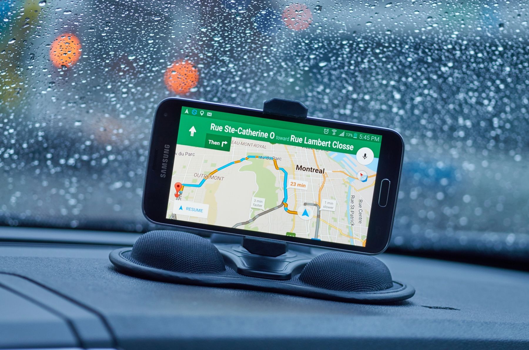
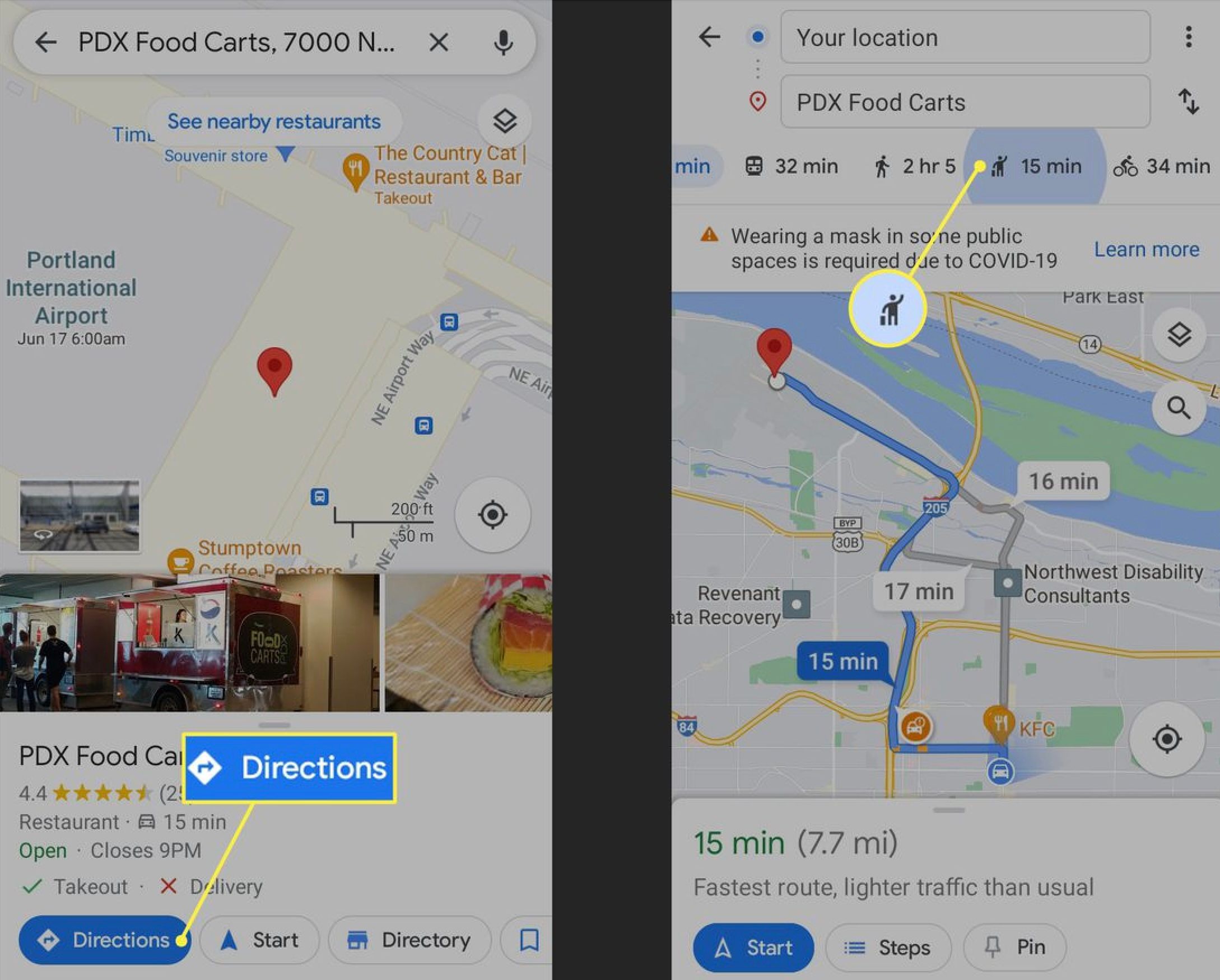
You probably use Google Maps to find specific locations, like restaurants, clubs, or shops. But that’s just scratching the surface. Google Maps offers so much more. It can give you a detailed picture of your journey— from real-time traffic and weather updates to air quality levels and potential delays. Want to know more? Let's explore these amazing features and ways to use them to enhance your travel experience from start to finish.
1. Use Glanceable Directions to Save on Battery
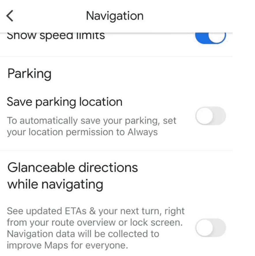
Under normal circumstances, you have to unlock your phone’s screen to view directions on Google Maps. But the Glanceable directions feature allows you to view navigation information like upcoming turns and the estimated time of arrival (ETA) without unlocking your device. This helps save on battery and enables a hands-free operation. You can also keep your eyes on the road without fumbling with your device.
Here is how to enable Glanceable Directions:
- Visit Google Maps on your device and locate the settings icon.
- Tap Navigation Settings on Android or Navigation on iOS.
- Toggle on the option called Glanceable Directions While Navigating.
Your route details will appear in the system notification at the top of your Android device. If using an iOS device, the details will appear in the Live Activities. You can access either without unlocking your device.
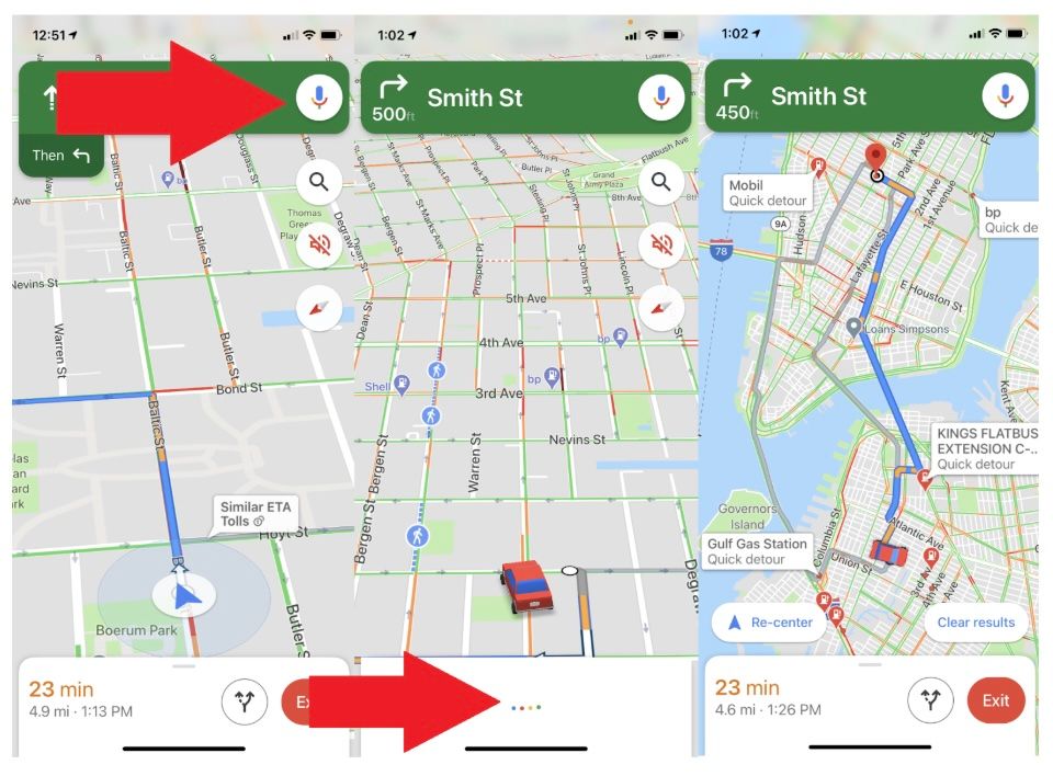
2. Use Voice Commands to Navigate
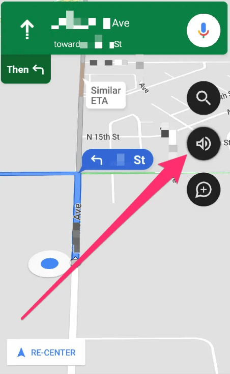
You need to keep your hands on the wheel and your eyes on the road while driving. Google Maps’ voice command feature, powered by Google Assistant on Android and a microphone option on iOS, lets you control navigation without touching your phone. You just ask your assistant what you wish to find. Here are a few examples:
“What’s the road like ahead?”
“What’s my next turn?”
“Are there restaurants along my route?”
Follow the steps below to activate voice commands:
- Activate the Google Assistant app on your Android (it works with version 9.0 or higher).
- Say ‘OK Google’ followed by your command.
- For iOS devices, activate the microphone in the top-right corner of the Google Maps app and speak your query.
3. Use Augmented Reality (AR) Live View to Navigate Unfamiliar Places
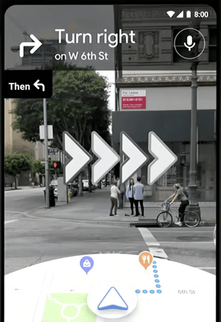
Have you ever been lost when walking across unfamiliar urban streets, even with the Maps app on? You can easily get confused, especially when buildings and intersections look the same. That’s why you need to leverage the Google Maps augmented reality (AR) feature. It adds directional arrows and prompts onto your phone’s camera view, showing you when and where to turn to reach your destination.
Unfortunately, the tool is available in select cities. You can use it in New York, Amsterdam, London, Paris, and Tokyo, among a few more cities. It also works indoors in over 10,000 locations. These areas include train stations, airports, and shopping malls. It makes it a lot easier to find specific areas in these crowded places.
Here is how to activate the feature:
- Search for your destination on the map and click the Directions feature.
- From the toolbar, select the walking mode.
- Scroll to the bottom of the page and tap Live View.
- Follow the instructions that you see on the screen to scan your surroundings using the device camera. You will see arrows and directions overlaid on the real view of your camera.
When there are turns ahead or when you reach your destination, your phone will vibrate to notify you about it.
4. Use Immersive View to Plan Routes
Google Maps gives you a chance to preview your journey with Immersive View. It offers a 3D bird’s-eye view of the route with details like street features, landmarks, weather conditions, and simulated traffic. This way, it helps you visualize the journey so you plan for things like means of transport, alternative routes, and what to wear. The feature is not available worldwide, though. You will find it in leading cities like Tokyo, Dublin, and New York, among others.
Activate Immersive View using the steps below:
- Start by searching for your destination.
- Tap directions from the available options.
- Select the Immersive View option in the route preview.
- Explore an interactive 3D rendering of your route. Zoom in to see details like buildings, parks, or road conditions.
5. Use Live View with Directory to Navigate Indoors
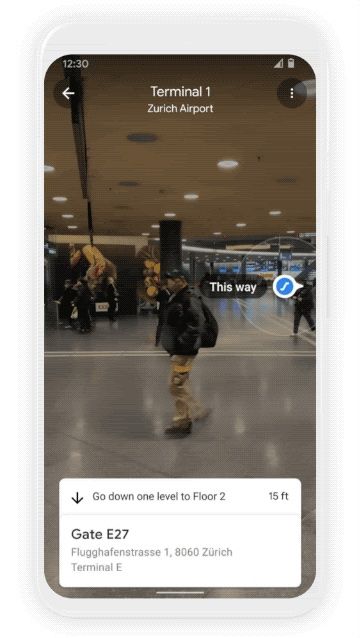
Google Maps has some amazing indoor navigation tools to help you find items in complex spaces. One of the tools combines the directory table and indoor live view. It helps you navigate airports, malls, and train stations with ease. This way, it ensures you do not get lost looking for a departure gate or a specific shop.
Here is how to use the feature:
- Look for a location to search. For example, Heathrow Airport.
- Tap the directory feature to see what different stores, gates, and services are within the complex.
- If the live view is supported in the location you are looking at, enable it too. This is to get AR-guided navigation where animated arrows point towards the area you wish to visit within the complex.
6. Offline Navigation with Google Maps
Let’s face it, sometimes you don’t have internet access or the battery charge is too low for you to stay connected during navigation. Google Maps lets you download maps for offline use. It allows navigation via GPS without a data connection. This is particularly helpful during international travel or when moving around remote areas with spotty coverage.
Here is how to apply the feature:
- Search for a city, region, or specific area you wish to check in Google Maps.
- Tap the location name at the bottom of the page or long-press the map to drop a pin.
- Select Offline Maps from the settings menu.
- Adjust the map area to download and tap Download.
- Access saved maps in the Offline Maps section under Your Places, even without Wi-Fi or cellular service.
7. Use Google Maps to Plan Multi-Stop Road Trips
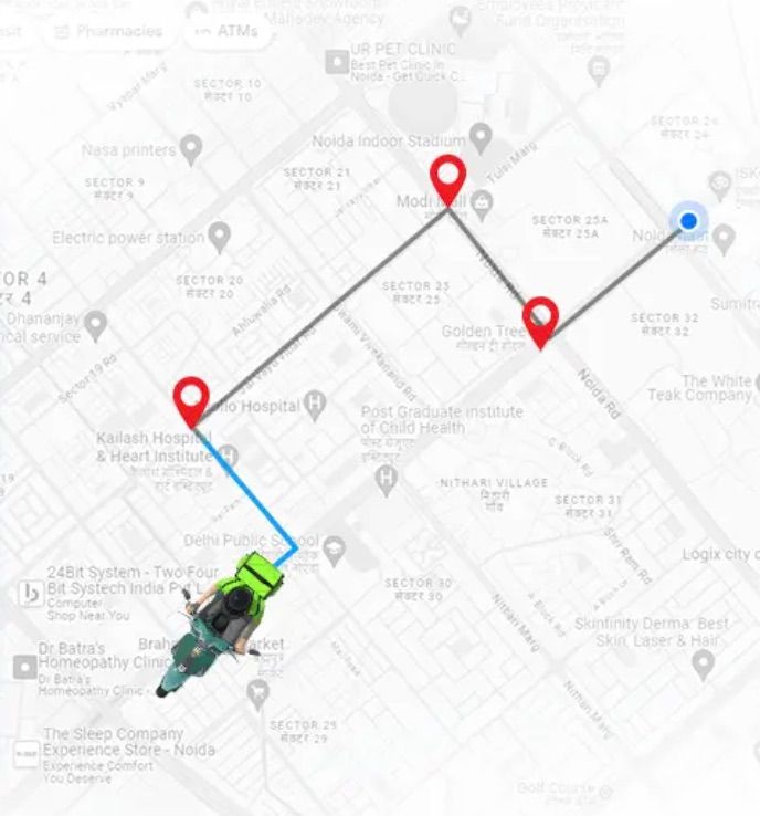
If you are running an errand or on a road trip, you may need to make a few stops on the way. Google Maps allows you to add up to nine stops on your way so that your itinerary feels streamlined. It ensures that you don’t fail to pick up items you need on the way or take that much-needed rest on a long journey.
You can activate the feature and add stops by following the steps below:
- Enter your starting point (current location) and destination in Google Maps.
- Tap the menu icon (three dots in the top-right corner) and select Add Stop.
- Search for additional destinations and add them to your route using the same process.
- Drag and drop stops to reorder them as needed. Finalize by tapping Done.
- Share your multi-stop itinerary via text, email, or other apps for group coordination if travelling as a team.
8. Share Hidden Gems with Your Friends
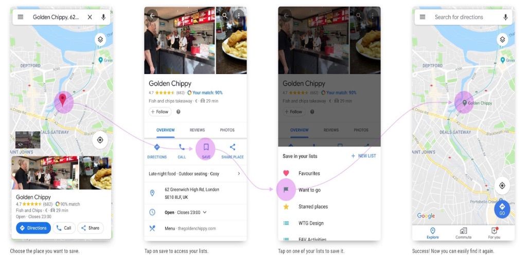
Want to keep track of your favorite spots, like those lovely coffee shops, hidden getaways, or weekend hangouts with friends? You can even share such lists with them to help plan a visit.
Here is how to save and share those places:
- Search the location you wish to visit and click save.
- If you have an existing list, add the name to the list.
- Otherwise, you can create a new one. On the top right side, click New List and give it a name.
- Check the saved lists under your lists on the saved tab
- If you want to share, click the three-dot menu text and tap Share List to send the link via email, text, WhatsApp, or other relevant apps.
9. Earn Rewards from Becoming a Local Guide
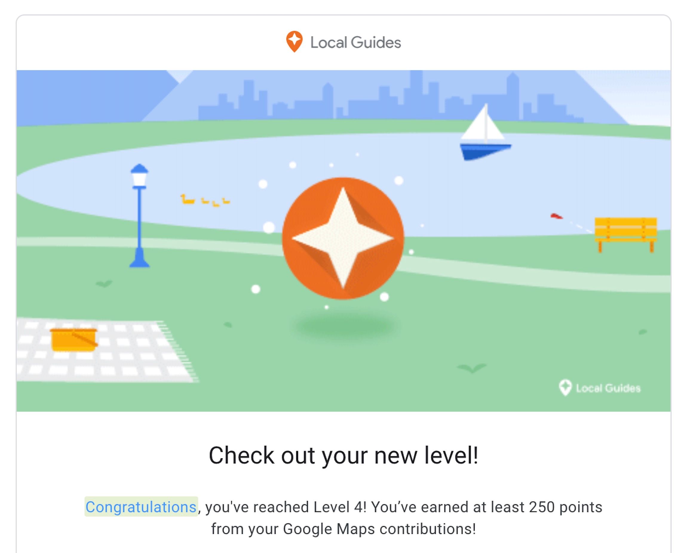
If you love the outdoors, you can share your favorite spots and earn some perks along the way. Google has a Local Guide program that allows users to contribute photos, missing places, and reviews to Google Maps. The earnings are in the form of points and credits. In the meantime, your contributions will help millions around the world find some of the hidden gems.
Get started with the steps below:
- Open Google Maps and check the Contribute tab on the menu section.
- Follow the prompts to sign up as a local guide. Then, start adding reviews, photos, or new locations.
- Earn points to unlock rewards. Some of the rewards include early access to new features, Google Drive storage, or invitations to exclusive Google events.
10. Use Incognito Mode to Navigate Privately
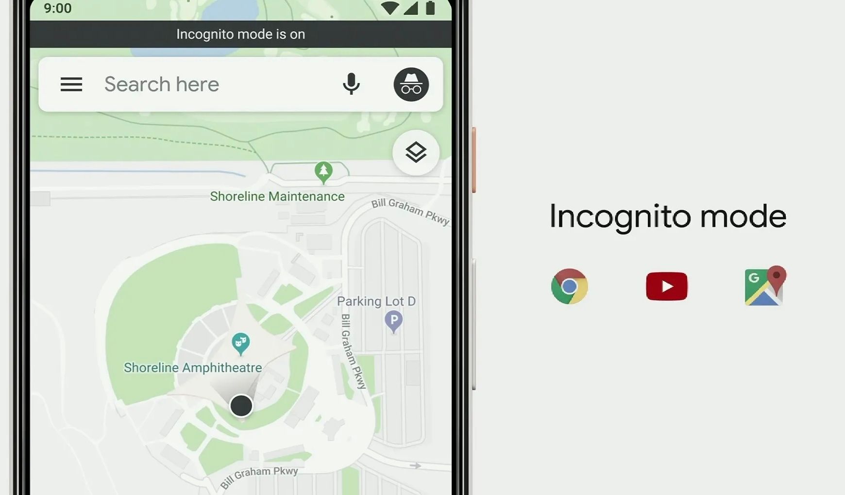
If you want your movements and searches to be private, activate the incognito mode. With the feature on, Google Maps doesn’t save your movements to your Google account. The only disadvantage is that you cannot review the places you visited.
Enable the feature using the steps below:
- Open Google Maps and locate your profile picture in the top-right corner of the page.
- Tap it to reveal several options.
- Select Turn on Incognito Mode.
- Navigate maps as you normally do. Your location will not be logged.
11. Find Routes You Can Access with Wheelchairs
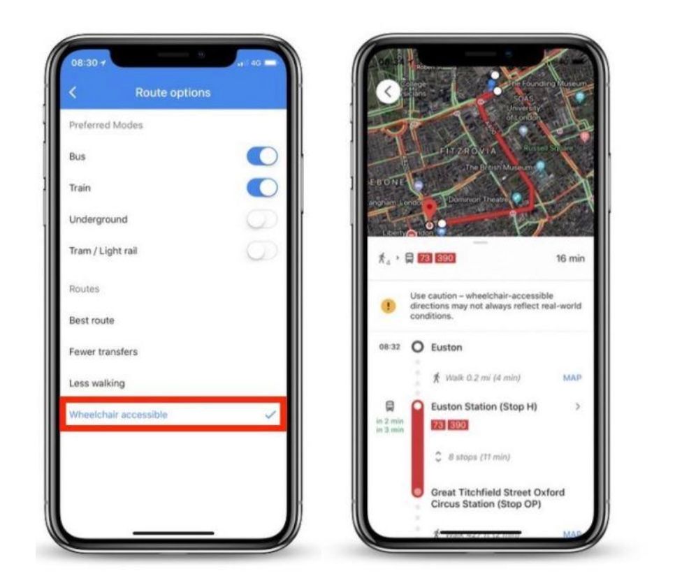
If you have mobility challenges and need to move around with a wheelchair, you can find accessibility routes with ease on Google Maps. This feature prioritizes inclusivity in public transport routes and places.
Find wheelchair-accessible routes with the process below:
- Search for a destination you want to visit and select Public Transportation.
- Tap the Options tab and choose Wheelchair Accessible in the Routes section.
- From the available options, click Accessible Places in Settings. Then, click Accessibility to view wheelchair-accessibility details for businesses and public spaces.
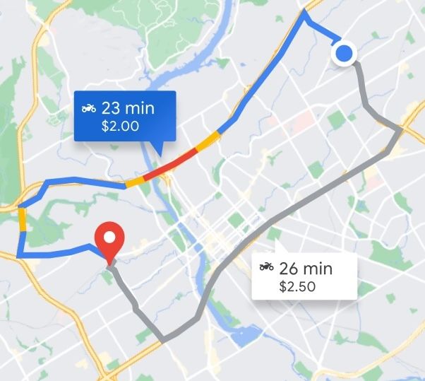
12. Book a Rideshare Straight from Google Maps
You can save time and effort by booking ridesharing from services like Lyft straight from Google Maps. It is a convenient way to plan your transport without tapping around too much. It also works well when you are in a new place and unsure how long the trip might take, given the multiple route options.
Below are the steps to book your ride on the app:
- Determine your destination and look for a rideshare icon (looks like someone hailing a taxi).
- Compare costs and wait times for all available services.
- Tap Open App to book your ride using the service you chose. Remember, you must have the apps on your device.
13. Check Restaurant Wait Times
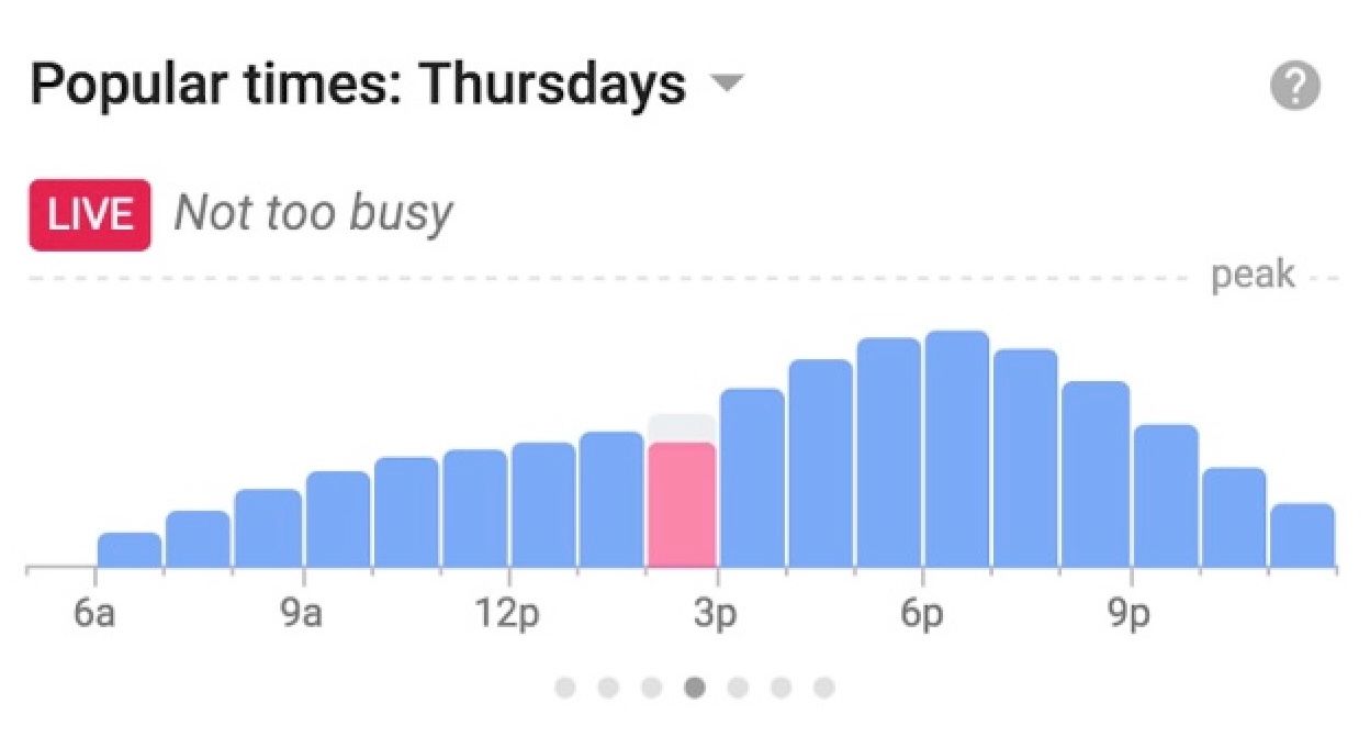
Are you in a hurry but hungry? You probably won't wait long for your meal. Google Maps has a feature that allows you to know the average wait time at restaurants along the way. The information is usually real-time but includes historical wait times, too.
Check wait times with the steps below:
- Search the restaurant that you wish to visit on Google Maps.
- Scroll to the Popular Times chat after tapping it.
- From the available options, select a specific time to view the wait times based on historical data. Some restaurants have real-time data available.
14. Distance Measuring in Custom Routes
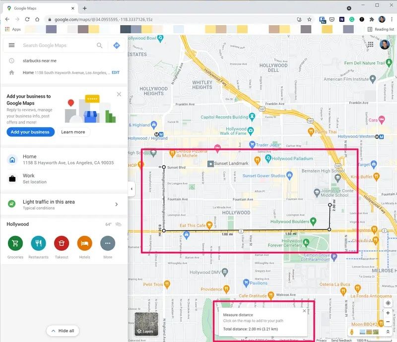
Are you planning some time outdoors hiking, biking, or walking? You can use Google Maps to measure the distance between any two points. This is key to determining the period it would take to reach a given destination or tailoring routes.
Measure distances with the steps below:
- When using the desktop version, right-click the starting point of your journey and select Measure Distance.
- If you wish to customize your route, click additional points on the way.
- Drag points if you wish to adjust or switch between metric and US units using the scale in the footnote.
15. Speed Up Navigation using Custom Labels
If you visit a certain location regularly, you can bookmark frequently visited places to simplify navigation. Google Maps allows you to create custom labels and give them names such as home, best coffee, etc., so you recall them with ease.
Here is how to go about it:
- Use the search function to get your destination and tap on it.
- Select the menu on the three-dot icon beside the destination you selected.
- Click Add Label from the resulting labels and create a name.
- You can search the labels using voice commands or searches to enhance your navigation.
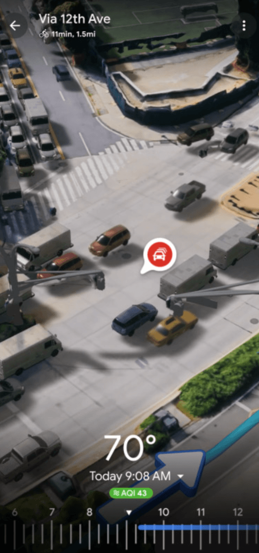
16. Determine Air Quality in a Location
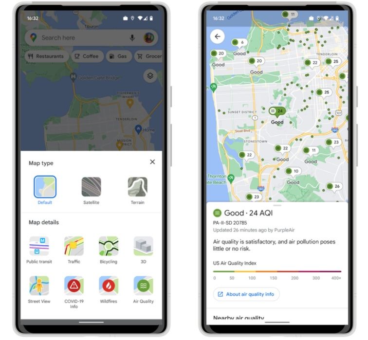
Pollution is a serious concern for most people. If you are planning to visit a place, it’s good you check the area’s air quality data first. Google Maps displays these details in the information panel of your chosen location.
Here is how to find it:
- Search the preferred destination and air quality details will appear next to the pinned location.
- If the data is unavailable, check the location’s information panel to view more details.
Much of the data is synced with the latest data sources. So, the information is usually up to date.
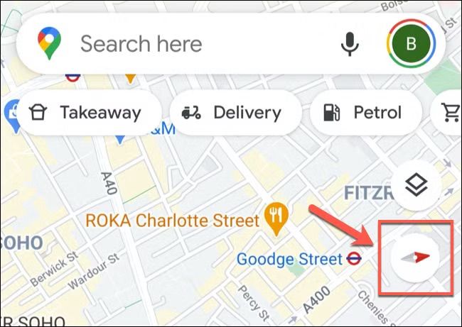
17. Enjoy Music while Navigating on Google Maps
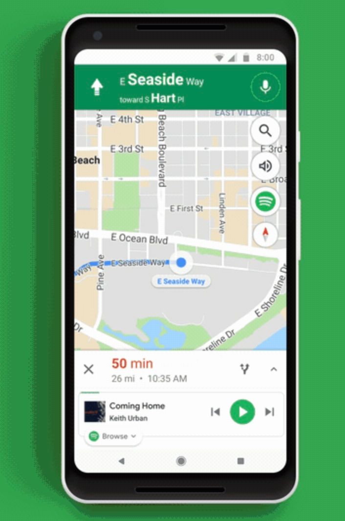
You can control your music without leaving Google Maps. The feature works with music apps such as Apple Music on iOS, YouTube Music, and Spotify. The syncing keeps you entertained without losing your focus.
Follow the steps below for syncing:
- Go to Settings and navigate to the Navigation Controls. If you are using iOS, click Music Playback Controls.
- From the resulting options, click Show Media Playback Controls. From here, select your preferred music app.
- During navigation, a music control balloon appears on the map. You can use it to play, pause, or skip tracks.
18. Go Back in Time with Historical Street View
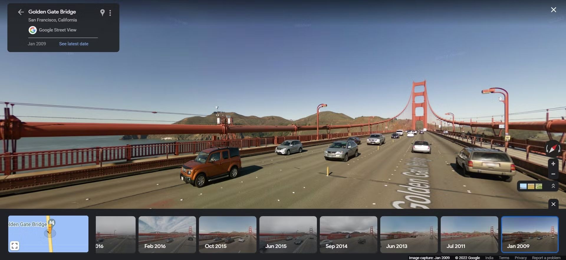
Curious about how a place has changed? Use historical Street View imagery to explore past versions of a location. This feature is great for nostalgia, urban research, or planning visits to changing neighborhoods. Unfortunately, this feature is only available on desktops.
Here is how to access it:
- Open Google Maps on your computer. Once loaded, drag the Pegman icon onto the map to enter Street View.
- Locate and click the timestamp in the top-left corner to view available past images.
- Scroll through different dates to see how the area has evolved.
19. Keep Track of Your Parking Location
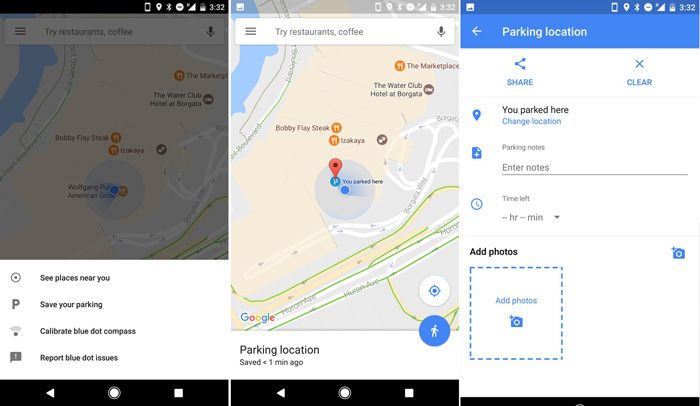
Have you ever spent minutes looking for your car in a crowded parking lot? It is quite stressful. The good news is, you can save your parking location in Google Maps, and even share it with anyone you would like to pick up in town.
Save the parking lot information with the steps below:
- Before you leave the parking lot, tap the blue dot on your current location.
- Select the option, Set as Parking Location, to drop a pin.
- Add notes to your parking lot so you remember important pointers about the location. Share the location via text or email using the share option.
20. Use Traffic Predictions to Plan Trips
Google Maps has a traffic estimation tool that allows you to preview traffic at specific locations based on historical data. This feature helps you schedule trips to dodge peak traffic hours, especially in urban areas. Unfortunately, the option is only available on the desktop.
Activate the option using the steps below:
- Search for a destination on the desktop and click the Directions option.
- There will be an arrow next to Leave Now. Click on it and select Depart at or Arrive by.
- Enter a specific date and time in the options to see estimated travel times and traffic conditions.
21. Use the Compass Mode to Navigate Dynamically
If you are walking on foot or biking, you may want the map to be oriented to your phone so you can move around with ease. The Compass Mode lets the map align to the phone’s orientation, which makes it easy to navigate on foot.
Enable the feature using the process below:
- Tap the compass icon, which is located in the top-right corner of Google Maps.
- Move your phone to see the map rotate in real time. It matches the direction you’re facing.
- Toggle between 2D and 3D views to get a richer perspective.
22. Share Your Real-Time Location
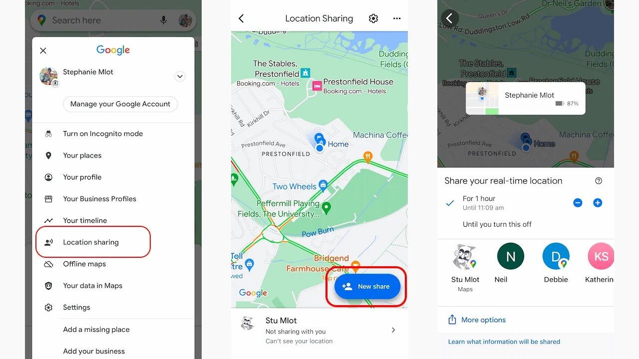
The real-time location allows you to coordinate meetups by letting your friends know where you are on Google Maps. It also works as a safety feature where family members can keep track of their loved ones.
Share your location using the steps below:
- Tap the blue dot for your current location on Google Maps.
- Select Share Your Location and choose a duration. For example, 1 hour or until the option is turned off.
- Send the link via text, email, or another app using the share option.
23. Preview Destinations with Mobile Street View
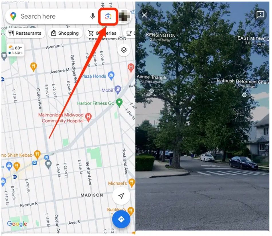
Get a virtual sneak peek of your destination using Street View on your phone. This is great for scouting restaurants, hotels, or attractions before you arrive.
Use the steps below to activate previews on mobile street view:
- Search for a location to visit. Tap the map to place a pin.
- Tap the Street View thumbnail at the bottom to enter 360-degree imagery.
- Swipe to explore streets, landmarks, or buildings virtually.
Final Thoughts
Google Maps is a powerhouse of navigation, exploration, and planning tools. It offers you more than the basic directions to enhance your navigation experience. Not to mention tracking tools, previews, and even features for people with mobility issues and those concerned with air quality. Where are you travelling next? Start experimenting with these features today and transform every journey into a seamless adventure!